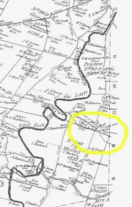
1870 Atlas of Clermont County
This is a portion from the Atlas of 1870 for Clermont County, showing (within the yellow circle) the approximate location of Noah Conover's land which he purchased from William Mosely in 1834.
At the top of this image is Marathon, the far right is Brown County, and highway 32 is to the south.
The numbers and associated large font names are the original military surveys, showing their boundaries and acreage. The smaller type indicates the owners of the land as they appeared in 1870, some 30 years after Noah sold out his interest in this area.
The yellow circled area appears below in closer detail.
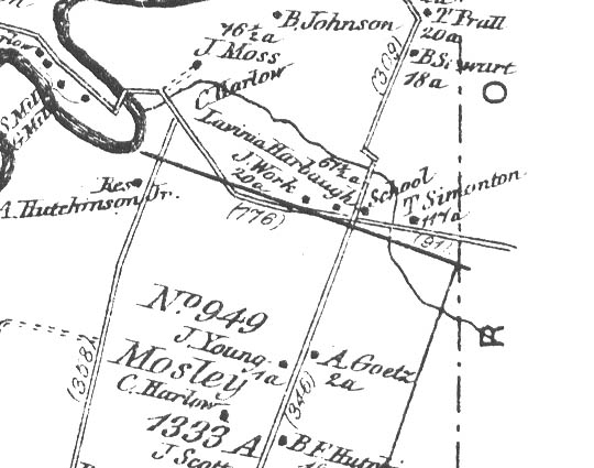
This is a closer view of the same area circled above.
Note the property of T. Simonton, 117 acres. To the left is Lavinia Harbaugh with 67.5 acres, and then a J. Work with 20 acres. Noah sold 95 acres to Reuben Harbaugh, Lavinia is his widow.
A school is shown as well in 1870.
Since Noah sold the 117 acre plat to Simonton before relocating into Brown county, Noah's family probably resided where T Simonton is shown on this map.
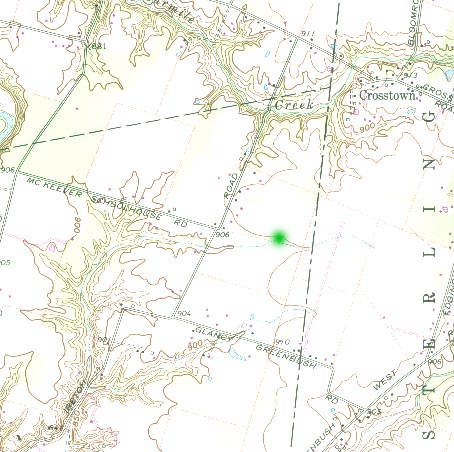
Modern topographic map of the same area as above.
The green dot marks the spot where Noah Conover and his family lived in Clermont county, until 1839 or so.
.